FalconView 5.1

Free FalconView is a mapping program developed for the Department of Defense
4.1 
Rating
Your vote:
License type:
Open source
Screenshots
1 / 2
Awards (1)
Show all awards
Software Informer User Rating 4
Open source
Used by 2 people
Request
Download
link when available

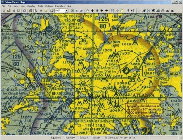
FalconView is a Microsoft Windows based mapping application that displays various types of maps and geographically referenced overlays. Many map types are supported, but the primary ones of interest to most users are aeronautical charts, satellite images, and elevation maps. FalconView also supports a large number of overlay types that can be displayed and printed over any map background.

Comments (15)

4.1
Rating
290 votes
5 stars
180
4 stars
37
3 stars
27
2 stars
15
1 stars
31
User

Your vote:

K
rating Koen
How can I download a full FalconView installation file to install it on a standalone device.

11 days ago Was it helpful?  yes(0) no(0) | Reply
A
ALVARO ACOSTA PONASSO
I use older version in aeronautical URUGUAY

Apr 14, 2023 Was it helpful?  yes(0) no(0) | Reply
S
rating Son
Very efficient. But the link is not available to download.

Oct 1, 2022 Was it helpful?  yes(7) no(0) | Reply

Facebook comments

Related software

Bentley View
Bentley View
Free
rating

Free DGN viewer, DWG viewer, and i-model viewer.

synedra View
synedra View
Free
rating

synedra View Personal is the free DICOM and multimedia viewer.

Fast MRC View
Fast MRC View
Free
rating

It's a small and fast program for viewing ISO 2709 format files.

Automapki
Automapki
rating

Add satellite imagery to AutoCAD, ZWCAD, and BricsCAD base DWG editors.

Fast View
Fast View
rating

It allows you to view a slide show of images in 3 formats.

Related suggestions

Falcon view maps free download

Tags

Open source Edit map US DoD Mapping Application Mapping program Map view Mapping software Editor Viewer